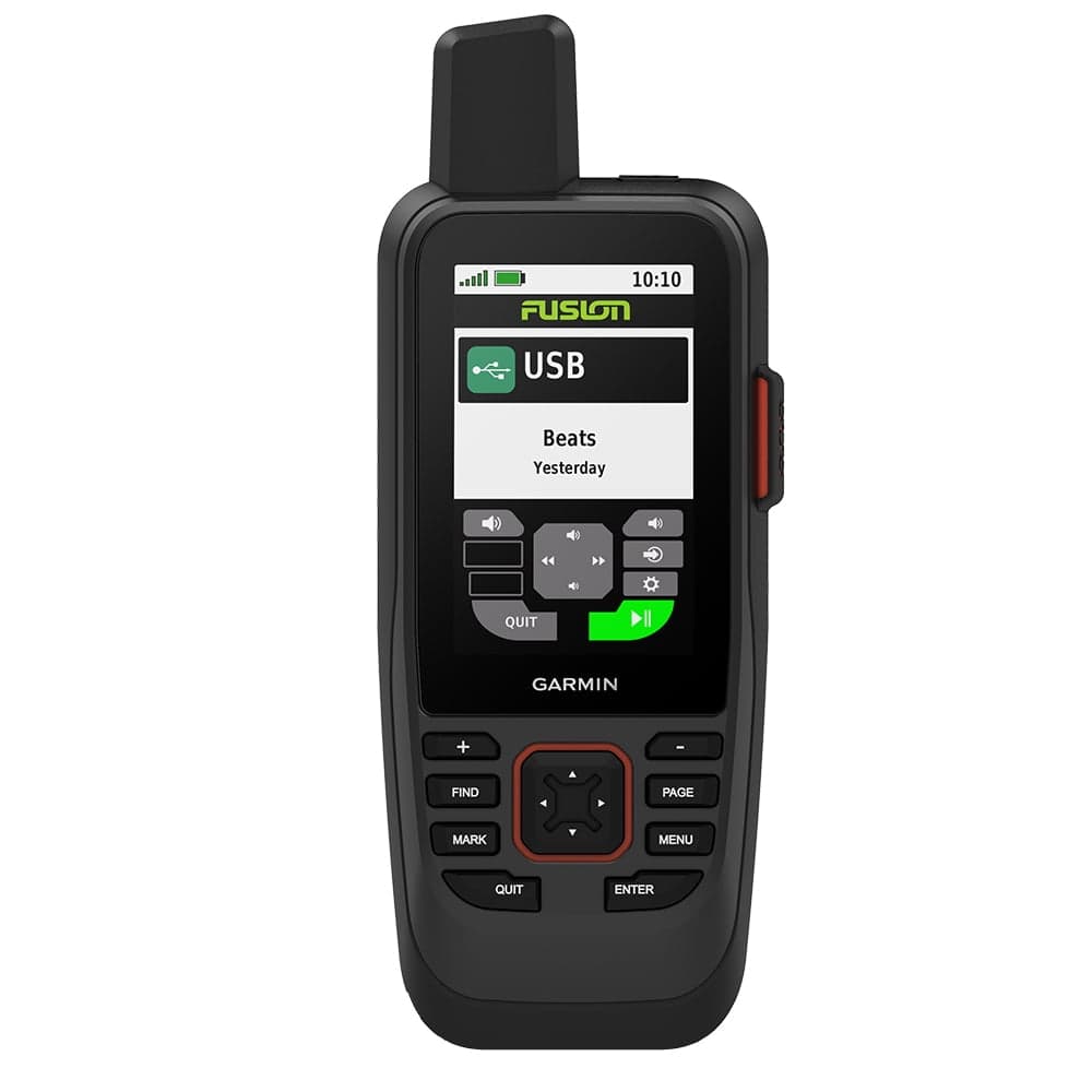
Garmin 0100223602 GPSMAP86sci Handheld
Water-resistant, floating design, sunlight-visible 3" display, and button operation provide ease of use on the water Stream boat data from compatible chart plotters and instruments to consolidate your marine system information Preloaded blue chart G3 coastal charts include the best of Garmin and Navionics data Stay in touch within reach through satellite communication and two-way text messaging via the 100% Global Iridium satellite network (satellite subscription required) Functions as a remote control for convenient operation of your Garmin autopilot and Fusion Marine products; to activate, download free apps from our Connect IQ store Adjustable GPS filter smooth speed and heading indications over swells A satellite subscription triggers an interactive SOS to the 24/7 search and rescue monitoring center
Shipping & Returns
Shipping & Returns